Software that enables management groups to improve efficiency, anticipate problems and run scheduled maintenance on buildings and facilities, is crucial to the economic successfulness of the property. jQueryMaps has unique solutions that incorporate interior mapping with advanced dynamic data to project many aspects of your business on a fully interactive map. The system would be developed to the needs of specific clients and accommodate the necessary flexibility for managers to update content and data with complete independence through a series of administrative tools. The ability to show changes immediately on the map is core to the success of the maps and administrative tools in general.
In this article we will look at:
-
Building Interactive Maps of your Buildings and Facilities
-
Linking Maps to CMS and Internal Data
-
Managing Updates and Filtering Data through Custom Maps
How to Integrate Custom Maps of Building Floor Plans and Grounds
 The process to build your first custom map is simple. In most instances, clients provide us with an existing dwg or dxf file export from an AutoCAD image made available by the architectural firm or development company that originally constructed the site. If these files are not available, cartography teams can be assigned the task of tracing the buildings and objects using a high-resolution image as a reference. In most cases, maps have numerous layers, and the ability to navigate between layers, floors, and buildings is key to successful indoor mapping software. We would link all of the floors and all objects pertaining to a floor (such as buildings on campus, floors within a building and rooms within a floor) via unique IDs. In most places, the IDs already exist on the dxf or dwg files, however, they can also be added later if needed.
When a project has a small to moderate number of buildings, we normally recommend working initially with our team to create the buildings internally. You would just need to send us your vector files, and we would produce all of the cartography and link the layers. For projects that need to work fully independently, or when buildings are added frequently, our team suggests creating a unique reader software that will interact with the dxf files and detect changes in real-time. As changes occur, for example, new buildings are added or rooms on floors are redistributed. The reader tool can process the layout updates without any manual work or user interruption.
Powerful Data Make Powerful Interactive Maps
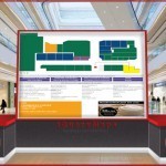
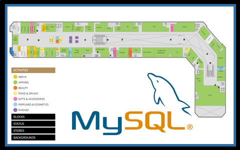 The key to any project is the data behind the map, the engine that powers the project. The more data available, and the ability to accurately interact and filter such data, is crucial to managing information using interior mapping software. The flexibility of our products does not require a specific predetermined data structure, and as such the maps can be linked to any existing database. It is common to work with enterprise software such as .Net/SQL, PHP/MySQL, Oracle, Java, SharePoint, Access, etc. You would simply need to provide us with an export of the database, and a description of how the data is structured in order for experienced technicians to develop all of the scripts to feed the information to the map via an XML file. As soon as data is changed in the database, the updates are immediately reflected on the map. This can include information for rooms, such as the assignment of an employee to a specific room and floor, or the contact information for maintenance in a particular building. If your company is currently using a software tool to manage the facility, such as a personalized content management system, we can tie the map to work with the same backend database. This means that changes will not need to be made to any of the existing software or code. See an indoor mapping tool created for a mall map.
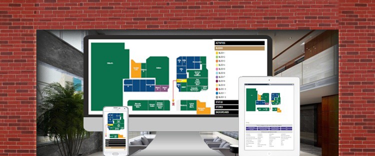
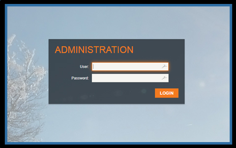 Maps can also include various layers of data visibility according to the access credential of users. For example, senior managers may be granted rights to see all data and make changes, while other staff would have limited visibility or editing privileges. This is particularly important for projects that will be accessed by multiple staff members or may even be displayed in part to the public. Restricting the amount of data available and the type of editing capabilities is common with our software, as the same map can serve multiple purposes: external use for the public, internal use, and advanced analysis use.
A final consideration for your project is the addition of filters, as limiting the window of data displayed on the map is very helpful to analyze opportunities for improvement. Common filters would be by revenue type, filters by data range or quarter, rent overdue or maintenance red flag filters along with any other data lookup for users. The following demo provides a lookup by category and name for a major US airport map
Applying Updates to your Interactive Map Project
Dynamic data needs to be supported by maps that provide the same level of flexibility. We understand that facilities interested in indoor mapping can have floor plans whose layout is constantly shifting. In the case of business offices, the positioning of cubicles and conference rooms can shift frequently and malls often promote new stores or season activity that needs to be displayed within the system. The first important discussion is to separate the data from the layout.
Map Data:
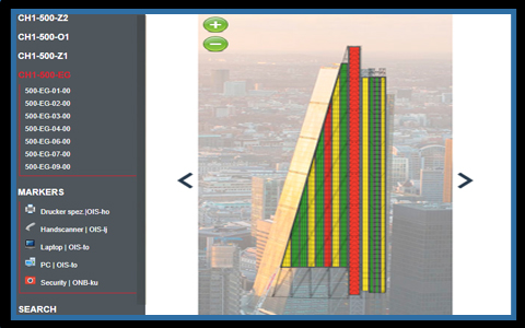
The map data is all of the content that is displayed in the map including information in tooltip boxes, the information in pop-up boxes and filters developed for specific searches. The data in a project can be linked to objects on the map (through unique IDs) as mentioned above or to icons displayed on the map. Icons are simple overlays on a map floorplan and can be useful for showing locations that change with high frequency or that require a special symbol. For example, fire escape exits can be assigned a characteristic icon in a project to help identify these positions, while temporary booths can also be displayed via an icon if they are only active for a short period of time or will move on a daily/weekly basis. All components of the data are database-driven, which means that updates can be easily made via an existing database table. To change a phone number, move and icon, or add a pop-up picture, users would just need to make a few updates in the database and the map will reflect the changes. Adjusting the map data is a simple task for any project. See an example of a DynamicLocator map that makes use of icons:
Map Layout
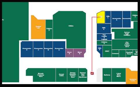 The map layout comprised of the objects that make up each map on each level. Simple maps may only include a single floor, while more complex facilities can have several floors and levels. The objects are shown on the map typically represent fixed entities that are linked to the information in the database via a unique ID. Depending on the type of project being developed, objects can include rooms, conference centers, sectional seating, tables, booths, stores or much more. Changes to the layout of a floorplan can be managed through a newly unveiled reader tool that enables clients to apply changes to a DXF file, which is read by the map in real-time to publish changes as they occur. Read more about the reader tool in the following article.
For more information about using interactive indoor mapping solutions for your business, we recommend a commitment-free consultation with our knowledgable staff to discuss the options available for your project. We look forward to hearing from you soon.
Share the post "Building Management Tools with Indoor Mapping Software"