While pandemics such as COVID-19 are not preventable entirely, society disposes of important tools that can be used to contain the impact that they have on our lives and world economy. A key factor in reducing the peak of a pandemic and the surge in hospitalizations is to catch cases early. By doing so, governments can apply effective containment measures and reduce the probability of the exponential spread of the virus. One of the most decisive tools we have available in our fight against pandemics is reliable information, which should be shared openly across borders. Getting an early edge on how a virus is being spread and what measures work effectively is crucial for countries to adequately prepare. Collaboration in collecting and analyzing data should be transparent. The use of technology can provide great leverage in our fight against pandemics, including the use of smartphones, health-specific Apps and interactive maps. As the world continues to brace against the COVID-19 virus, we can draw important insights on what measures are working and what needs to be improved.
In this article, we will look at the following topics
-
Using Smartphones to Analyze Ongoing Pandemic Information
-
Combining Data Analytics and Interactive Maps
-
Discussing Data Privacy Issues
Deploying Apps and Technology to Stay Ahead of COVID-19
 The world has developed new technologies and strategies that are commonplace to most industries, but many of these practices have not yet been adopted into public healthcare. We live in an interconnected society in which most citizens communicate freely and share data daily on smartphones. Many of the Apps that we use come with standard technology that can be employed to provide crucial information on the spread of a pandemic. Health-tracking Apps on phones are often configured to collect data on a user’s level of activity, heartbeats, body temperature and sleeping patterns. At the individual level, this information is useful for meeting health goals, but when combined with thousands of users, the information on aggregate can provide real-time insights on how a population’s health is fairing compared to baseline values and neighboring communities. These statistics can be included in interactive maps and models that work to predict flare-ups in our cities. Furthermore, once cases are confirmed, geotracking offers an effective method to trace the movement of a smartphone to determine locations that might have been exposed. While there are important privacy safeguards that need to be strictly observed, the ability to use health data to fight pandemics is a notion that many governments are discussing.
Another helpful tool when fighting a pandemic is abiding by social distancing measures. This can be applied both as a preventative measure as well as a mechanism to reduce exposure even when a patient falls sick. The act of immediately going to a doctor or community health clinic might be unnecessary and potentially put others at risk of contagion. New tools are available for patients to communicate with their healthcare providers virtually as a means of diagnosing their illness and monitoring care. Doctors can use telemedicine with specific software to care for multiple patients while monitoring vital signs in order to determine which cases are in most need of in-patient care. Technology can provide an effective means for doctors to prescreen patients and administer first-level support while reducing the strain on the medical system and avoiding unnecessary contagion.
Learning from Interactive Maps and Real-Time Data
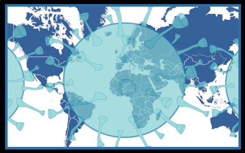
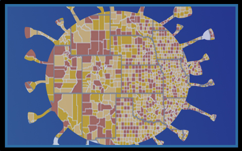 By using the technology that we currently have available, apart from developing new specific tools, society can gain an important advantage in containing COVID-19 virus and establish protocols for battling the next pandemic. The data on the number of contagions, fatalities and recoveries worldwide will need to be parsed and analyzed in depth. It will be crucial to highlight the trends that may appear in the data, to see where the protective systems worked best and where improvements are needed. Part of the analysis will be to project the numbers on interactive maps, outfitted with filters and historical replay options, to examine how the virus spread. Differences in the surge of patient cases and eventual outcomes can be included in the maps, and measured based on political decisions taken on the ground. For example, it will be insightful to create interactive maps of the progression of the virus in different cities and filter the cities according to demographic statistics, while at the same time contrasting the results according to safety protocols that were adopted. Considering that there are numerous variables at play, some of these trends can be difficult to observe just by the human eye. In this scenario AI can be engaged to uncover subtle patterns that may yield important insights into our battle with COVID-19.
Safety Considerations and Privacy Concerns
 Detractors of the idea of using consumer technology to monitor the spread of the pandemic have valid concerns that would need to be addressed before any successful policy is put into place. One of the biggest worries revolves around what guarantees can be made that the information is completely anonymous. Safeguards would need to be provided to ensure that any tracking of location, activity and health-data be kept entirely anonymous and used exclusively for the purpose of containing the pandemic. Continuing along this line, it would also be necessary to offer guarantees that once the emergency is lifted, all tracking measures be immediately removed and data thus far collected, be treated with utmost privacy. All of these positions require significant oversight and ample consideration from governing bodies. This is another argument in favor of transparency and dialogue to make sound decisions that balance the need for safety with the value of personal privacy. As analysis of the COVID-19 outbreak continues, both during and after the immediate emergency, many of these ideas will be debated as we prepare for what might come next. In the meantime, we hope that everyone does their best to stay healthy and safe during these uncertain times.
Share the post "Mapping COVID19 with Interactive Maps and Dynamic Data"