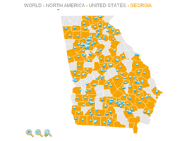
Get some inspiration!
You have more than 140 projects to choose from.
jQueryMaps let's us create maps in many different ways. Check out these useful samples of jQueryMaps to see what other people are doing with our solutions. Please call us toll free at 1-866-392-0071 or write us at support@jquerymaps.com if you don't find the example you are looking for.
- All
- Apparel/Retail (2)
- City Guide/Travel (6)
- Commerce (5)
- Education (13)
- Energy (3)
- Finance/Banking (10)
- Gastronomy (3)
- Government (6)
- Healthcare (8)
- Home Construction (1)
- Hospitality (1)
- Industrial Manufacturing (5)
- Insurance (2)
- IT (5)
- Logistics (4)
- Media (4)
- Miscellaneous (29)
- Non-Profit (8)
- Real Estate (16)
- Recreation (2)
- Telecommunications (3)
- Web Development (4)
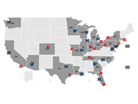
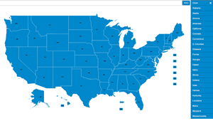
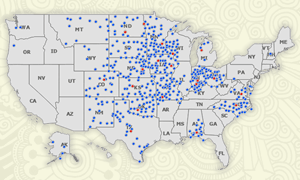
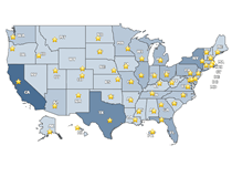
USA States
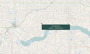
Map displays solar locations across the US. The tool includes a legend, two categories of icons, mutiPOIs and multiPOI pop-up boxes.
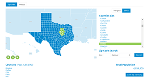
Army Statistics map
Map developed to show statistical information about Army deployment and other data ranges within a USA State, County and Zip Code map. Map also features custom filters, results table, fixed labels and an export to pdf feature which automatically embeds the export of the map within a dynamic page that can be printed.
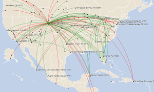
Route Map
Airline industry map with connecting lines and animation that connects a departure city with the destination.
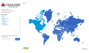
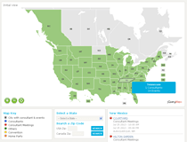
World Rep Map
World Map with USA States and Counties and Canada Provinces and Counties. The map was developed as a sales rep locator tool to be used within a public page of the website. The pop-up box includes contact information for the reps and a direct email link.
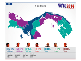
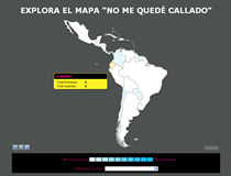
Panama Provincias
Election map designed to display real-time election data for the national elections in Panama in 2014.
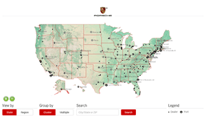
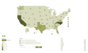
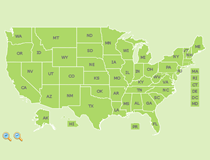
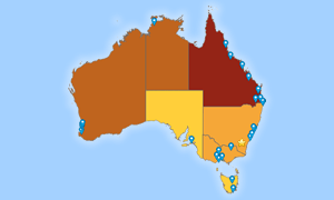
Regions and Locations
US Map with terrain background cartography and custom icon filter to alternate views between clustering or grouping icons in multiPOIs
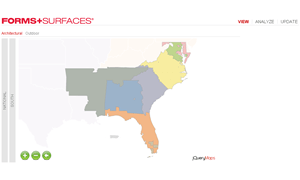
Custom Sales Divisions
Custom map was created for architectural manufacturing company to analyze sales data by custom regions through a multi-level map. The tool also includes an integrated feature to automatically change the assignment of Counties and Zip Codes to different regions. This tool is used to generate new cartography sets with custom divisions in just minutes.
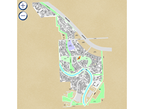
Neighborhood Divisisions with OSM
Project was designed to interact with an admin tool to display neighborhood divisions on OpenStreetMap, inteface with each divisions to update content, and actually redesign divisions as neighborhood limits change. The geo tool allows for admin users to drawn new neighborhoods to the map as needed.
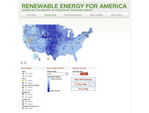
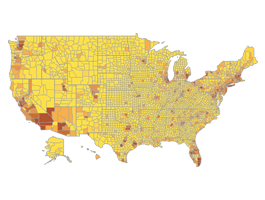
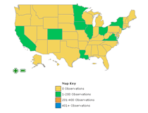
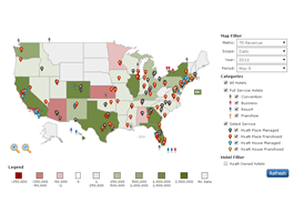
USA States & Counties
Highly customized US States and Counties map that includes an advanced system of filters, custom icons, graphic overlays and categories by Wind, Solar and Geothermal.
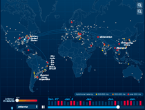
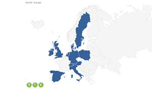
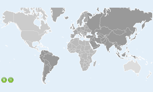
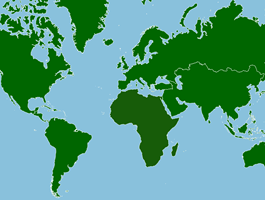
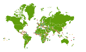
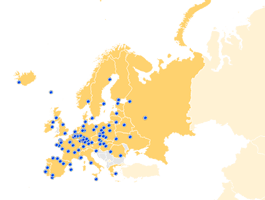
World & Continents
World Map created to show internet connections between servers in real-time with the addition of dynamic connecting lines.
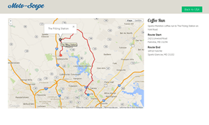
Routes on Google Map with Admin
jQueryMaps USA States map combined with GoogleMaps to feature top level and street-level views across the US. The map works with an admin tool to draw and save popular motorcycle routes across the US.
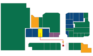
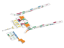
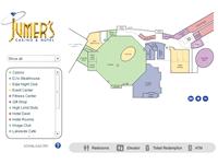
Kiosk Mall Map
Demo created for a Kiosk company as a sample for how the map could be displayed to show store locations and navigation from a fixed kiosk to any store location. You must scroll down in the page to view the map initially:
World Rep Map - Reponsive
World Sales Rep map with USA States detail and custom continent divisions. The project was created from an Excel sheet and uses a system of macros to produce the XML that populates the map. The pop-up box also includes a form to insert information and sends an internal email to the respective rep and blind carbon copies to select people.
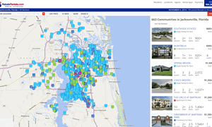
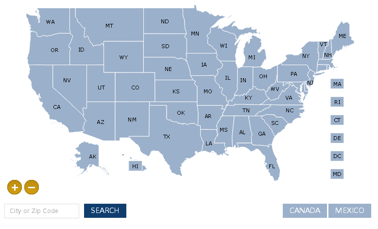
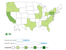
Zip Code Map - Responsive
US States, Counties and Zip Code map design to display within responsive websites. This map resizes automatically and adjusts for horizontal view on mobile devices. It features side search panels in jQuery for quick results lists at any level. These side panels can be adjusted and customized for any project
USA States, Counties & Zip Codes 5
USA Counties and Zip Code 5 divisions with customization so that the Counties are shown initially with the zoom passing through the State.
World Sales Rep Map
World map provides color coding to define regions and coverage areas for diffferent sales reps. Depending on the reps working in a particular Country, more or less information is displayed within the pop-up boxes. The pop-ups include the company logos, coverage description and options to email with a bcc copy included. Additioal detail, is the custom zoom for larger continents to focus on primary areas of business and maximize map view.
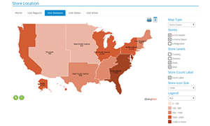
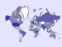
World Map with Census Regions and Territories
Custom solution was created to provide a powerful retail store analysis tool. The map uses custom cartography and a series of filters to interact with the large volume of data. To improve presentations, the map also has the option to adjust the icon size and level on which stores are shown.
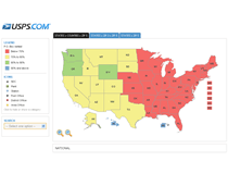
USA States, Counties, Zip Codes 3 & Zip Codes 5
Map built for USPS to show PO box occupation by USA States, 3 digit and 5 digit zip code map. Includes filters and zip code overlay feature.
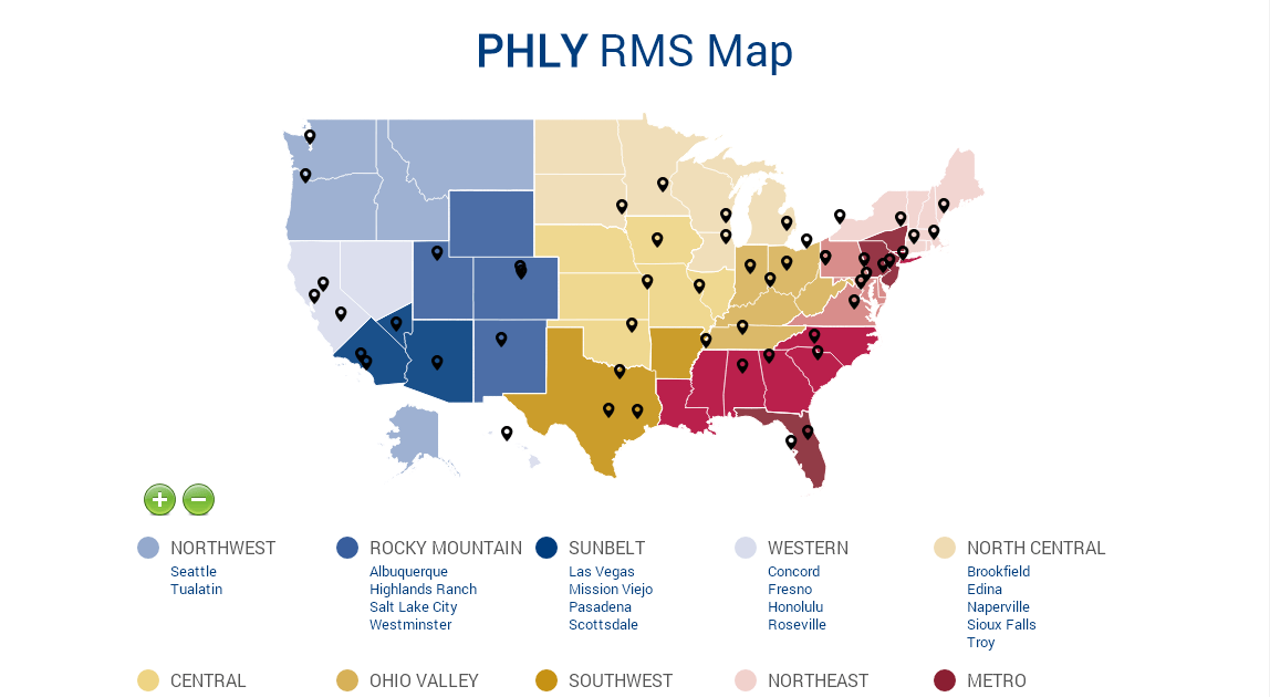
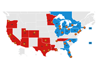
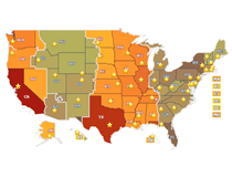
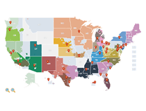
USA States Sales Rep Map
US Map provides color coding to define regions and coverage areas for diffferent sales reps in the US. Depending on the reps working in a particular State, more or less information is displayed within the pop-up boxes. The pop-ups include the company logos, coverage description and options to email with a bcc copy included.
Indianapolis International Airport
DynamicLocator indoor map of the Indianapolis International Airport. Includes filters, searches and routing
USA States & Canada Provinces
World distributor map. Project includes a time stamp and custom pointer to enhance the appearance of the map.
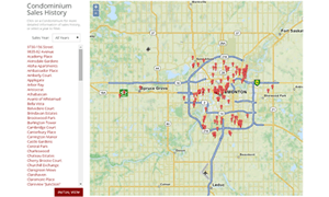
OpenStreetMap - Condo Sales
Condo sales map with simple search and year filter. The project was also created with an admin tool to easily update content displayed on the map
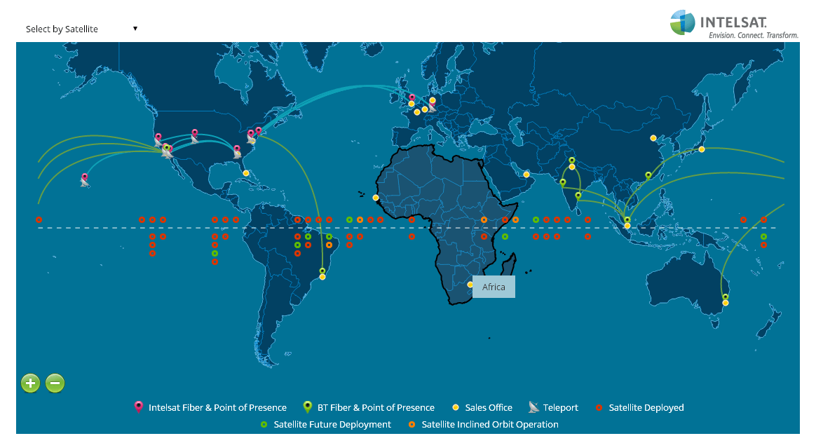
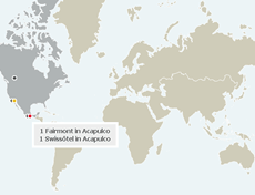
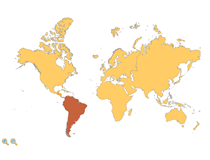
World Map with Satellite Locations
World Map that features connecting lines between specific locations, different categories of icons and a detailed pop-up with embedded content through an iFrame in the pop-up displayed on the tip of Brazil.
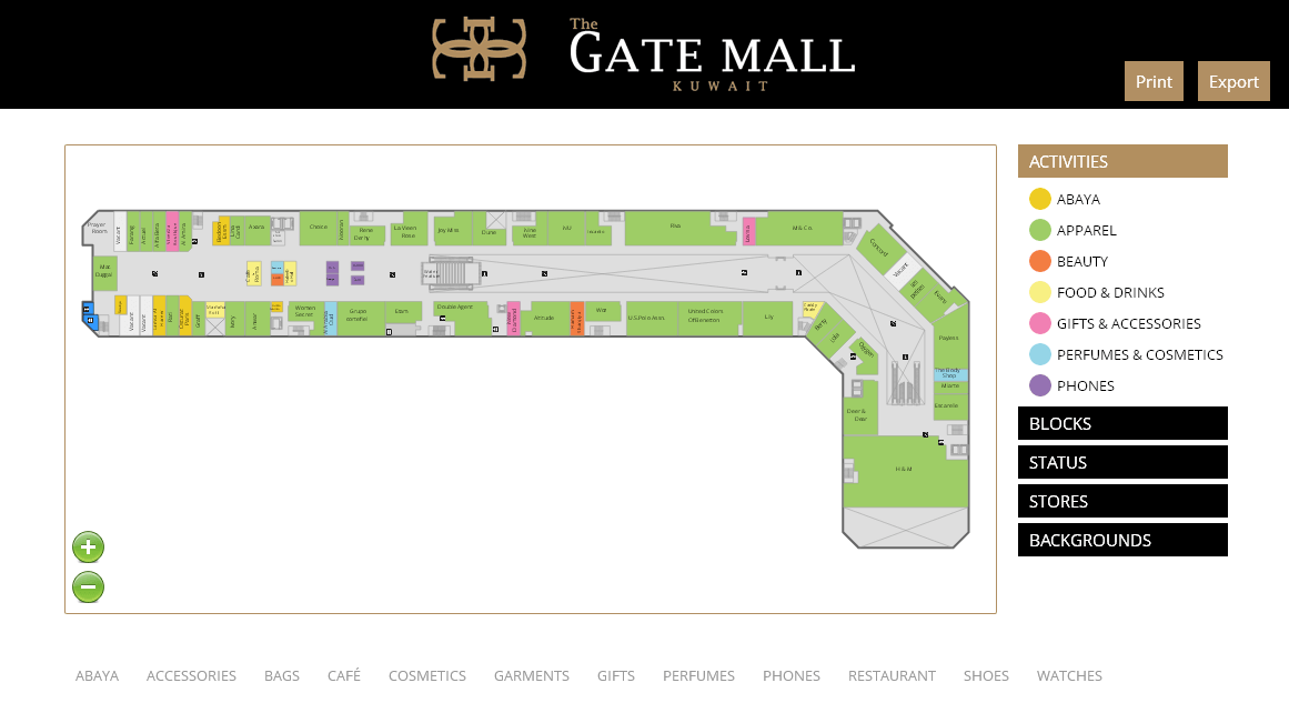
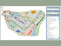
Custom Mall Map / The Gate Mall
A custom interior mall map designed to work as part of a self-maintained custom application. The responsive map includes a system of filters, pop-up images and options to export and print.
USA States Map with Side Bar Filter
USA States Map with side filter that enables a client to select a territory to highlight on the map. The system is designed to initially focus on the portion of the territory that displays markers, while highlighting the entire State area.
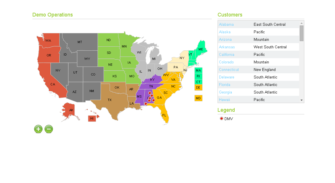
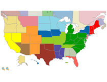
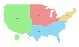
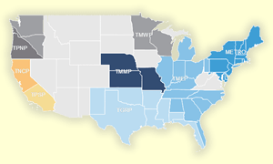
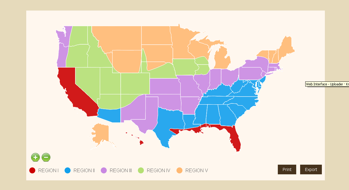
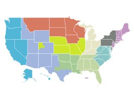
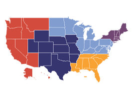
USA States and Custom Regions
USA Map divided into custom regions per client territories. Each territory is assigned a specific color and information is listed within the map and results table.
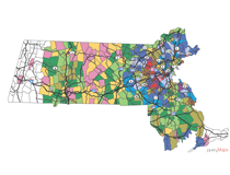
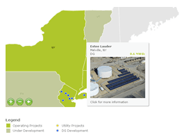
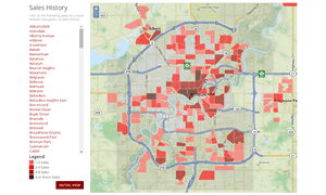
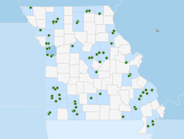
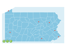
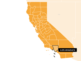
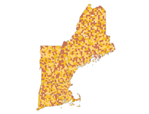
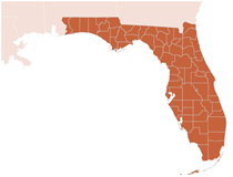
Single State Townships
Real Estate Map created for realtor in Massachusetts. Features Township divisions with statistical information about property value and taxes for each location.
Customized street detail
jQueryMaps has been working extensively with Rebate Rentals to enhance the mapping features of their website. The latest map component features OpenStreetMap with a number of indexed queries that reflect on the map instantaneously.
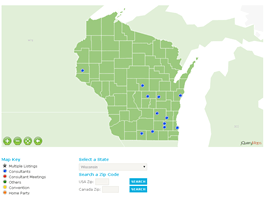
USA States & Canada Provinces
Meeting locator map with several categories of icons, filters and search tools.
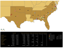
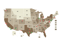
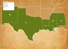
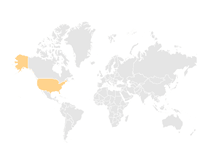
USA States
Custom map of the US displaying distribution facilities in the Southern US. Map features a results table with sales and volume statistics and tool to compare locations.
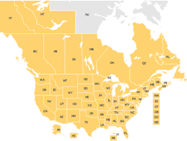
USA States & Canada Provinces
Member locator map for both the World and the US that makes use of results table and zip code search tools that interact with the cartography.
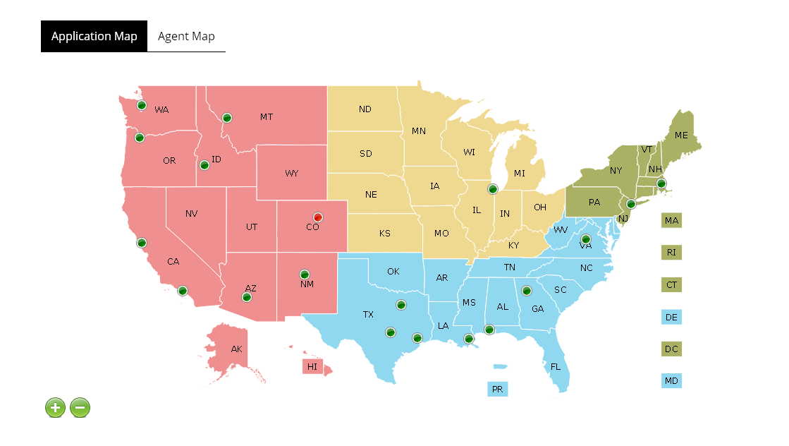
USA States & Canada Provinces
Sales territory and agent locator map of the US and Canada. Map features custom divisions and detailed pop-up box.
Custom Regions within State
Deed lookup map includes custom divisions by townships and sections, where the range is not visible but passed as a variable when any area is selected. The IDs of all selections are passed in a JavaScript function and can be used to populate specific information in the website.
USA States
Major real-estate Company uses jQueryMaps to display locations throughout the US divided by property category. Includes advances filter and results table
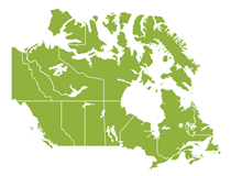
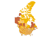
Canada Provinces
Canada Province Map that includes Energy statistical information in area pop-up boxes.
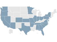
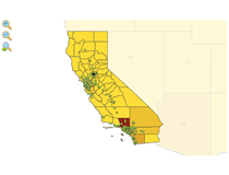
USA States
Souplantation/Sweet Tomatoes operates 97 salad buffet-style restaurants across the western, southern, and eastern portions of the United States.
USA States
Buy and sell new or used goods, look for a car or job, find local events, meet local people and lots more. And do it all for free!

USA States
A full-time investment property management staff with skills ranging from Investment Property Analysis and Consulting, dedicated Property Management, Leasing and Marketing, as well as Relocation Logis

USA States
The Federal Reserve is an independent governmental entity created by Congress in 1913 to serve as the central bank of the United States.

USA States
National Wildlife Federation inspires Americans to protect wildlife for our children's future.
USA States
Map of USA States used at a conference to display sales initiatives amongst agents with a list to populate values

USA States
Alon USA's objective is to provide the highest quality fuel and convenience store products at the best customer value.

USA States
CVP seeks outstanding risk-adjusted returns through the deployment of capital to opportunistic investments in superior real estate projects located throughout the United States.
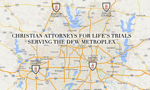
Regional map - 4 Counties
A simple map created for Chakery Design showing 4 County area with roadways. Each County links to a separate page.
USA States
Champps Americana is a national chain of restaurants focusing on beer, burgers, and sports.
Custom Territories
Project created to feature company specific custom territories. The map was generated with custom divisions and includes several display features to locate cities within each region.
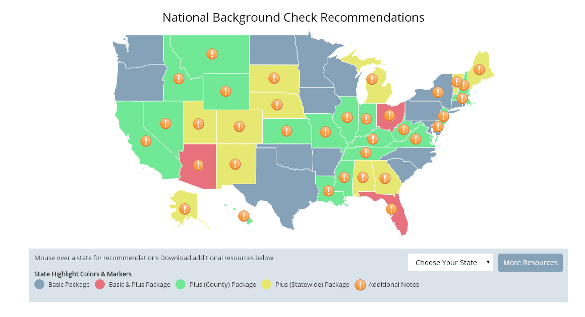
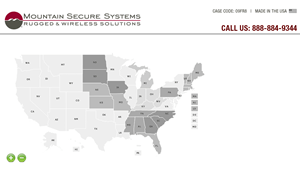
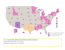
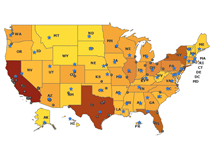
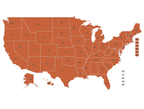
USA States Map with Informational Boxes
USA States map that includes color coding of States based on status categories. Select States also display an icon with added information and notes in a box below the map.

USA States
Collegetownz.com is your very own school website. That's right, your very own focused networking site with local friends, coupons, deals, and more.
USA Zip Codes & MSA divisions
Map is part of a custom area selection tool that allows users to define areas by zip codes or MSA divisions in order to purchase advertising. Results are highlighted on the map and listed in a results table below by region.

USA States
Container Alliance is a group of small to midsize mobile storage companies, working together to co-utilize marketing and administrative benefits that are typically enjoyed by the business leaders in o
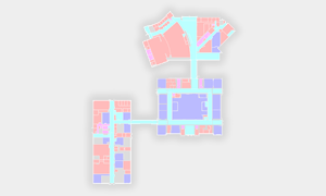
Interior warehouse building
Demo created of a single floor plan with dropdown filters by different categories
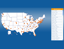
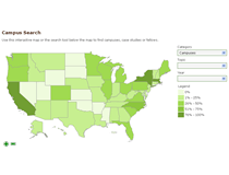
US States and Cities Contact Map
USA States map with a list of cities in which application are being accepted. The pop-up for each city location includes a form to be filled by the user, which automatically emails the information to a predetermined email address. The form also accepts uploading of files to be included as email attachments

USA States
The exceptionally friendly and hard working team members at every Drury Hotel share the same simple virtues that the brothers learned on the family farm and adapted to the road.
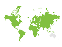
World with Icons at Global View
World demo created with several categories of icons displayed at the World level

USA States
The purpose of the Petition Project is to demonstrate that the claim of “settled science” and an overwhelming “consensus” in favor of the hypothesis of human-caused global warming and consequent clima
DynamicLocator with OpenStreetMap
Cemetery finder map was enhanced with a back button to link with OpenStreetMap to provide users with the ability to see town information and distance relative to the cemetery.
OpenStreetMap - Local Use
The system library and cartography cells are all local so the map runs without an internet connection
USA States
Major real-estate Company uses jQueryMaps to display locations throughout the US divided by property category. Includes advances filter and results table
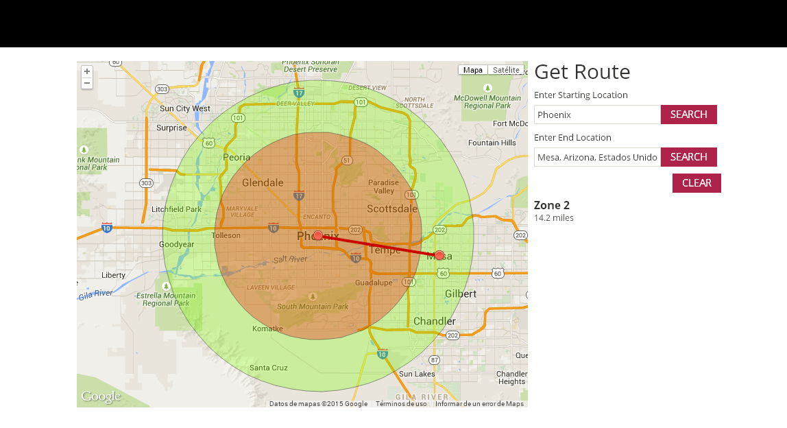
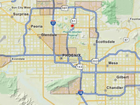
Circle Territories on Google Map
Customization on a Google Maps api to include an address search to define a starting and ending point. Examples to see information can be (55 North 51st Ave / 10 E Main St, Casa Grande, Arizona). The map traces the route, provides the mileage and traces circle overlays around the starting point. These circles from the starting point are set at 15, 25, 30 & 45 miles.
USA States
LearningRx learning centers provide cognitive skills training that empowers every child to learn faster and easier. Tutoring and other programs reinforce WHAT students must learn (information).
USA States and Counties - Responsive Map
USA States and Counties map with city/state search box and results table. Map is responsive and hides when less than 480px wide.

USA States
The Michigan Department of Community Health and its partner organizations have developed online assessments and websites to help promote and support better health for Michigan citizens – in communitie
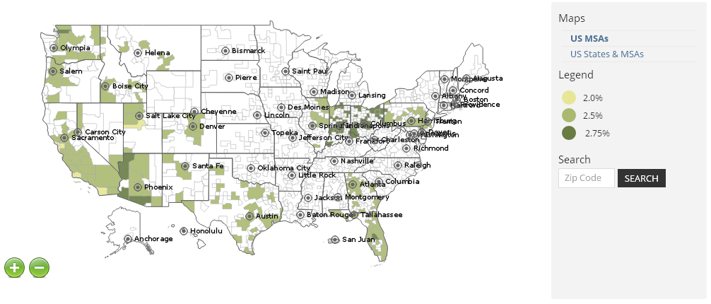
USA States and MSAs
USA States and MSA map that includes major cities, a zip code lookup which highlights the area and color coding of areas based on specific values.

USA States
NDLON improves the lives of day laborers in the United States. NDLON fosters safer more humane environments for day laborer, both men and women, to earn a living, contribute to society, and integrate
USA States and Custom Regions
USA States map divided into custom regions to define different areas of treatment across the US.

USA States
The National Survey of Programs and Services for Homeless Families is a timely and useful resource for service providers, advocates, researchers, and public policy makers working in the field of famil

USA States
Shapiro, Lifschitz & Schram, P.C. is a Washington, DC-based law firm with a unique flair. We apply our experience, infuse our passion, and deliver solutions for our clients in the areas of business, c
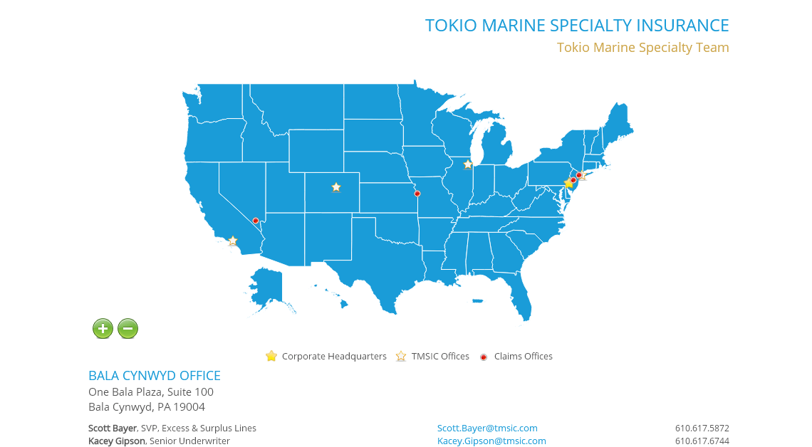
USA States Map with Google Maps
USA States map with office locations, detailed results table and multiPOI icons. The project also includes Google Map view as an embedded object within the pop-up boxes.
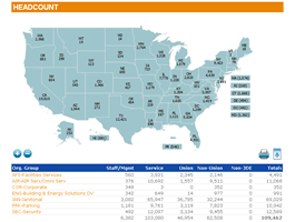
USA States & Counties
Map for organizing and displaying employee statistics. Includes custom search and statistical information as fixed text.
USA States, MSAs & Counties
Several cartography layers that are called through a side panel filter. The map includes Counties and MSA divisions displayed at the national view.
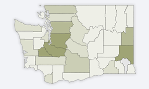
Washington State & Counties
Statistical map showing projects available throughout WA State & Counties
USA States & Counties
Government agency using a State and Counties map to plot field offices and regional offices throughout the US.
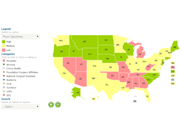
World, Continents, USA States & Counties
Map designed to display hospital locations in the US and internationally with navigation down to the US County view.
USA States & Counties
USA States and Counties project designed to pull from JSON data and work within SAP Design Studio
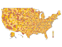
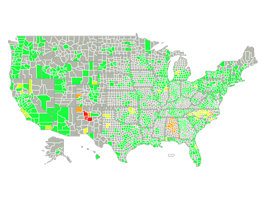
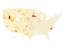
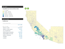
USA States & Counties
Demo featuring 2010 Population Statistics displayed on a USA State & County Map with major cities.
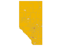
Canada Alberta Municipalities
Map of a single Province of Alberta, Canada with Municipality divisions.
USA States & Counties
Regional map with State and County divisions displaying contact information for each facility. Map includes a background to match client website.

USA States & Counties
Loadmaster is a construction system for the roof Deck assembly that provides composite performance.


USA States & Counties
PESG is the predominant employer of substitutes in the Great Lakes Region. As of 2008 over 22,000 substitutes work with PESG to serve in our local school districts.

USA States & Counties
The 1% program of Public Architecture connects nonprofit organizations in need of design assistance with architecture and design firms willing to donate their time pro bono.
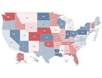
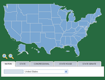
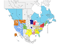
US States, Congressional, State Senate & State House Districts
US Demographic map with tab filters by cartography. Features divisions by States, Counties, Congressional/Senate/House Districts

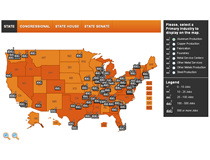
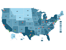
US States, Congressional, State Senate & State House Districts
Economic impact map of USA States + Congressional + State Senate + State House
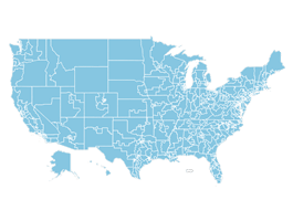
US States, Congressional, State Senate & State House Districts
Economic impact map with cartography of of USA States + Congressional + State Senate + State House
US States, Congressional, State Senate & State House Districts
Economic impact map of USA States + Congressional + State Senate + State House

USA States & Congressional Districts
Founded in 1906 and Headquartered in metropolitan Washington, DC, AMI is a national trade association that represents companies that process 95 percent of red meat and 70 percent of turkey in the US a
Single State Zip Codes 5 & Custom Regions
Statistical data map with filters and pop-up boxes. Also includes client specific regions.
USA States, Counties & Zip Codes 5
Map created for NWF as part of a campus ecology initiative, displaying locations at the Zip Code level.
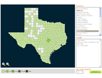
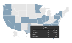
Single State Counties & Zip Codes 5
Single State Map of Texas with County and Zip Code divisions. Project includes a custom pop-up box with images and video.
USA Zip Codes 5
Territory map based on US Zip Codes shown at the national level. Dynamically displays areas based on database table for easy update of any region.
USA States, Counties & Zip Codes 5
Map created for NWF as part of an EcoSchool initiative. Features USA State, County and Zip Code divisions.
USA Zip Codes 5
Agent lookup map with custom territories. Map loads in real-time with zip code divisions that can be updated on the fly.
USA States, Counties & Zip Codes 5
Project created for NWF to display ecological pledges across the US. Features divisions by State, County and Zip Codes
USA States, Counties & Zip Codes 5
Map created for NWF as part of a project to plot wildlife sightings across the US. Information displayed at the Zip Code level.
World, Continents & USA States
Custom design and filters that allow users to easily locate properties on a map at the World level.

World, Continents & USA States
World map with custom regional divisions displayed in the initial view. Map is designed to display office locations around the World based on internal regions.
World & Continents
Member locator map for both the World and the US that makes use of results table and zip code search tools that interact with the cartography.
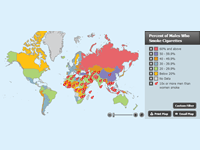
World & Continents
One hundred million people were killed by tobacco in the 20th century. Unless effective measures are implemented to prevent young people from smoking and to help current smokers quit, tobacco will kil
World & Continents
World Map created to display University travel abroad programs and professors focus in each Country.
World & Continents
World Map with information in the US. Designed to display bank locations in the US with information about hours and contact for each facility.
World & Continents
Timeshares Only is the world's largest timeshare resale marketplace. Through co-operative advertising, Timeshares Only makes it possible for timeshare buyers, sellers and renters to connect around the

World & Continents
CEVA Logistics is a logistics company, formerly known as TNT Logistics. CEVA designs, implements and operates complex supply chain solutions on a national, regional or global scale for medium to large

World & Continents
Habitat360 is the world’s bazaar of international real estate and luxury property rentals, connecting buyers, sellers and renters around the globe.

World & Continents
The American Association of Colleges of Pharmacy (AACP) is the national organization representing pharmacy education in the US. Our mission is to both represent and be an advocate for all segments of
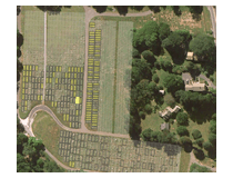
Centerbrook Cemetery Map
Custom DynamicLocator application designed to locate plots within a cemetery.
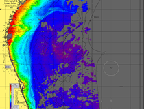
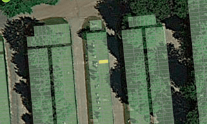
OceanTemp
Custom map solution that provides high resolution satellite photo images for the fishing industry
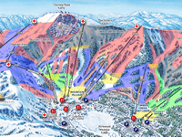
Kirkwood Mountain Resort
Tucked away about 35 miles southwest of South Lake Tahoe, Kirkwood Mountain Resort offers big Mountain skiing/riding.
USA States & MSAs
USA State and MSA division map with an advanced filter and custom results table with profit statistics per location.
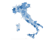
Italy Regions & Provinces
Project is designed to display client specific data and employs a series of filters adjust the categories and ranges shown on the map.
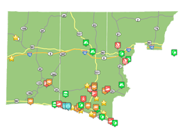
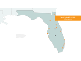
Regional - County & Townships
Vacation project showing custom icons for categories and events in Freeport, FL area

USA, Canada & Mexico Counties
North America distributor map created with custom divisions by territory
USA States, Counties & OpenStreetMap
Project featuring sample icons at the County level with integration of OpenStreetMap. The final project includes labels and was configured to work with JSON data.