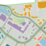
In the new reality that we have come to know in 2020, society is much more aware of our social behaviors and potential risks inherent with many of the activities that once formed integral parts of our daily lives. It has also come to the forefront that technology is a cornerstone of our modern society and a beacon of hope in our efforts to stay connected and maintain productivity. Within the larger role that technology plays in our quotidian routines, we also examine the interconnection of devices and how IoT can be deployed to save lives during pandemics. The interpretation of the information that new technology provides is equally important to making meaningful decisions and interactive maps play a big role in displaying data for easy interpretation. Many of the interconnected devices store data to servers and include GPS information to faithfully plot the movement of objects around a facility. This can be highly insightful when conducting contact tracing, facility maintenance, and patient diagnostics within any service facility.
In this article we will look at the following topics:
-
Interconnected Thermometers in Hospitals and Care Centers
-
Maps built for Sensor Bracelets and Custom Apps
-
Immediate Response Buttons within Facilities
IoT within Hospital Facilities Provide Immediate Data
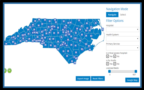 Parts of the developed world brace for a potential new spike in patient cases as social restrictions are lifted. In light of this scenario, it is important for hospital facilities and care centers to improve efficiency as they prepare for potential increases in inpatient admissions. The use of technology and connected devices can provide brave frontline workers with an additional tool to confront the COVID-19 pandemic. If patients within care centers are administered devices that monitor their temperature in real-time, it would minimize the attention doctors and nurses need to give to this task, while also providing immediate alerts at the outset of a fever. The thermometers are designed to gather information and make the results readily available to caretakers overseeing an entire floor or hospital wing. Any deviation from standard data can be mapped using interactive maps to quickly show the location of concern and monitor all personnel that may have been in contact with the particular room. These results are displayed in real-time, but can also be played back using historical data for deeper analysis. For cases where patients are confirmed to have COVID-19, thermometers can assist workers with timing the introduction of certain medicines based on fluctuations in temperature and other vital signs. Pairing technology with the ongoing care of nurses and doctors can improve the medical response while limiting exposure to caregivers.
Monitoring Patient Data in Real-Time with links to Interactive Maps
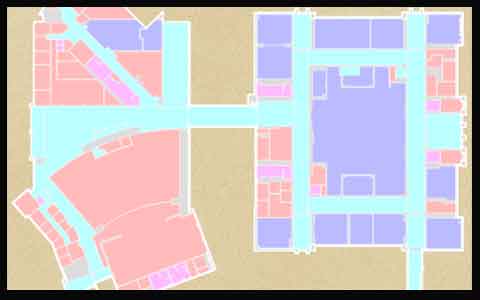 The possibility that IoS devices, potentially as simple as bracelets, also include GPS data, would provide facility administrators with a quick reference of the movement of patients and easy data for future contact tracing. The same devices can provide numerous services by continuously monitoring the vital signs of a patient, such as oxygen levels, heart rate, and temperature to detect any trigger signals of infection. There have also been manufacturers who developed a bracelet geared towards preserving social distancing, which works with GPS to detect the location of the patient and calculate the distance from any other bracelet in the proximity. If a closeness threshold is passed, then both bracelets immediately vibrate to alert of a possible risk. Since it is easy for these devices to connect in real-time to a server, the GPS values of each bracelet are stored and used to plot the movement of patients within a facility on an interactive map. The data can be displayed live while also configured to offer analysts a heatmap based on historical data from the past couple of weeks showing the evolution of movement within buildings. The information is entirely anonymous, but highly insightful in the event of an outbreak. Since all alerts would also be stored as data occurrences, it would be fairly simple to know when two bracelets were in close contact with one another with a risk of contagion. For contact tracers, this data is vital for quickly containing any flare-ups, especially within high-risk communities such as assisted living facilities.
Immediate response buttons within Facilities
 Interconnected systems of alerts can be easily integrated with the existing infrastructure of a building. These devices, in many cases developed as emergency buttons, can be called in an instance to alert personnel of any number of issues that require immediate attention. In the case of COVID-19, these can be situations where equipment maintenance in a patient room is required or when a doctor’s attention is needed urgently. Buttons can also trigger alerts for other issues such as spills, shift changes or resupply of medicine. As the data around the alerts is stored on a server, it can be easily called in the future for analysis. These reviews can show potential situations for improvement within the facility framework. Response systems can also be used within inactive commercial areas to monitor the use of utilities. Given that many plants are running at a reduced capacity, energy can be allocated to other areas of the manufacturing chain and whenever spikes occur, such as surges in water or gas usage, a detection system can quickly alert attention to these urgent cases to avoid damage within the building. All the incidents, along with other important management information can be mapped and accessed remotely with interactive maps.
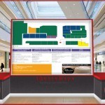
jQueryMaps specializes in custom mapping solutions for companies, with a particular focus on interactive maps of facilities, campuses, and venues that combine database structures to populate objects and information on maps. The end products enable users to interact with the floor plans, view information, and make changes to be saved in the system. Feel free to contact us to learn more about our mapping solutions.
Share the post "IoT and Interactive Maps – Devices that can save lives"